Arête Survey Solutions: Your Surveyor in New South Wales
- Over 25 Years of Industry Experience
- Registered Land Surveyors Servicing All of NSW
- Cutting-Edge Technology, Including Drone Surveys
- Accuracy, Efficiency, and Compliance in Every Project
Contact Us
Who We Are
Arête, in its basic sense, means "excellence of any kind" and at Arête Survey Solutions, we are always committed to providing the peak of excellence in professional surveying and spatial services.
Arête Survey Solutions is an established registered land surveying firm based in Canowindra and servicing all of NSW. Our team is our most important asset, and we encourage them to attend regular professional development seminars to expand their knowledge and expertise and ensure they are kept well-informed of policy and technological releases within the profession.
Efficiency and precision are qualities that Arête Survey Solutions aims to achieve when working with all our clients. Our team understands the importance of the surveying services we provide and the vital timing requirements associated with them, and we aim to exceed incomparable service every time.
Our registered land surveyor is Greg Doherty. He is a NSW registered land surveyor with over 25 years of experience in the industry. His surveying roles have seen him abroad in Abu Dhabi, Dubai, New Caledonia and throughout Australia, including New South Wales, Western Australia, Queensland and the Northern Territory.
Why You Need A Surveyor
Surveyors play a crucial role in land development projects. They are responsible for conducting various tasks, such as conducting boundary surveys to determine property lines, topographic surveys to assess the natural features of the land, and construction surveys to ensure accurate placement of structures. They also handle land title surveys to establish ownership rights and prepare legal documents. Additionally, surveyors may assist in site planning, providing essential data for infrastructure design and ensuring compliance with regulations. Overall, surveyors are instrumental in the successful development of land, ensuring accuracy, efficiency and adherence to legal requirements.
Our Services
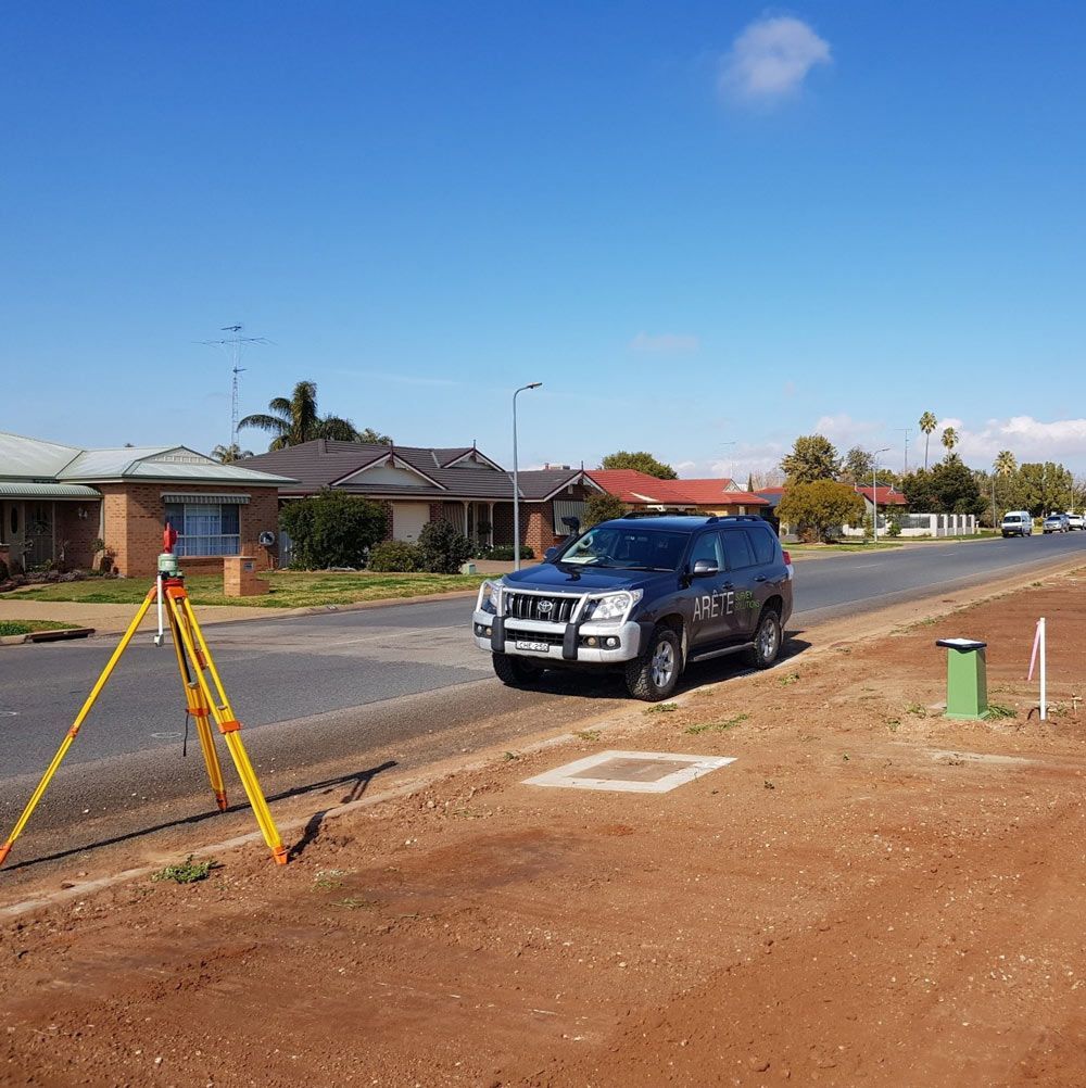
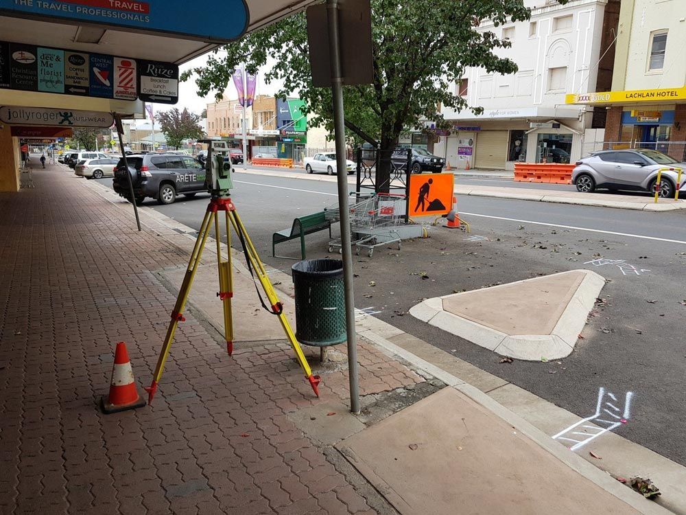
- Surveying: Our core service encompasses a wide range of surveying solutions—from boundary surveys to topographic assessments. We provide the critical foundation for land development projects, ensuring accuracy and compliance every step of the way.
- Cadastral Surveying: Understanding property boundaries and land ownership is a fundamental aspect of land development. Our cadastral surveying services ensure clarity and precision in defining property lines.
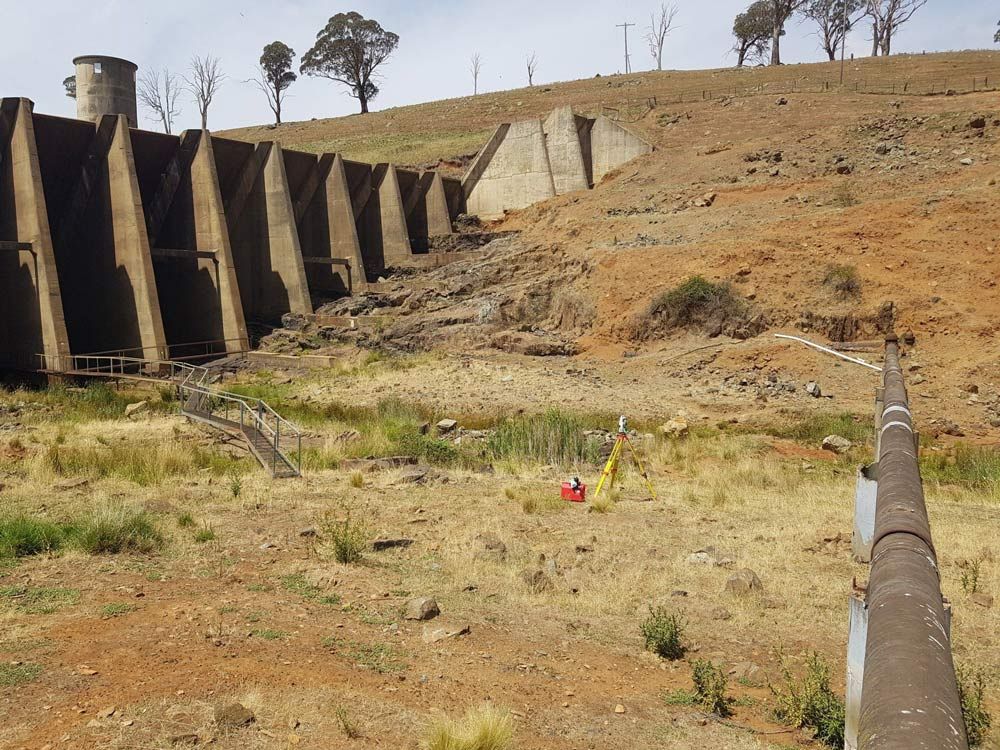
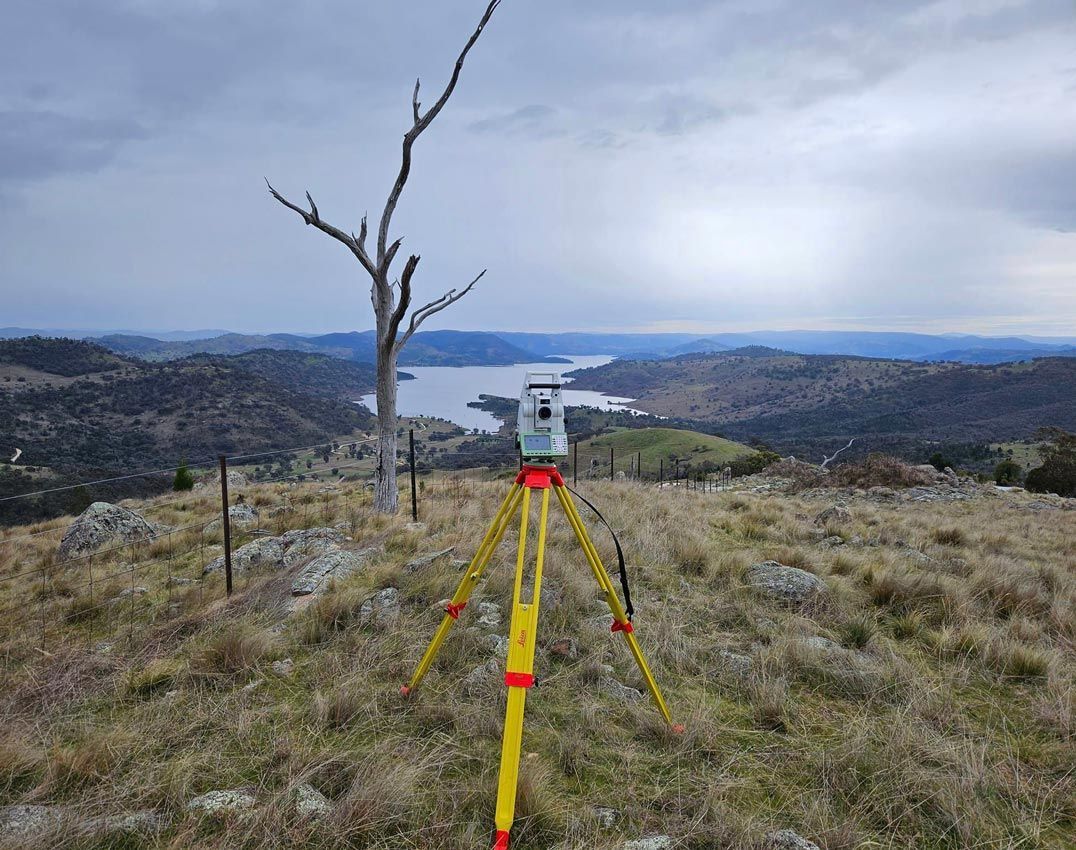
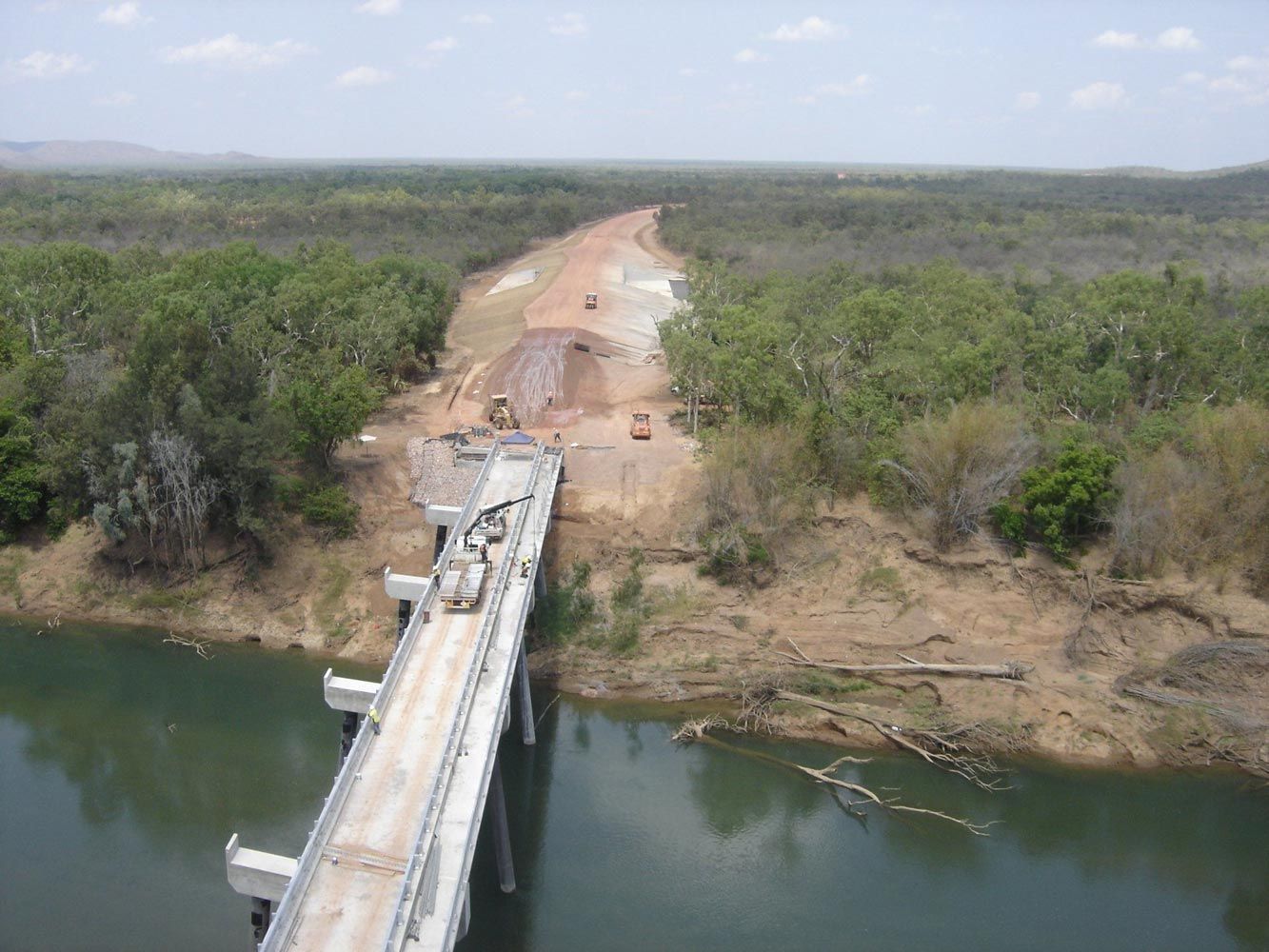
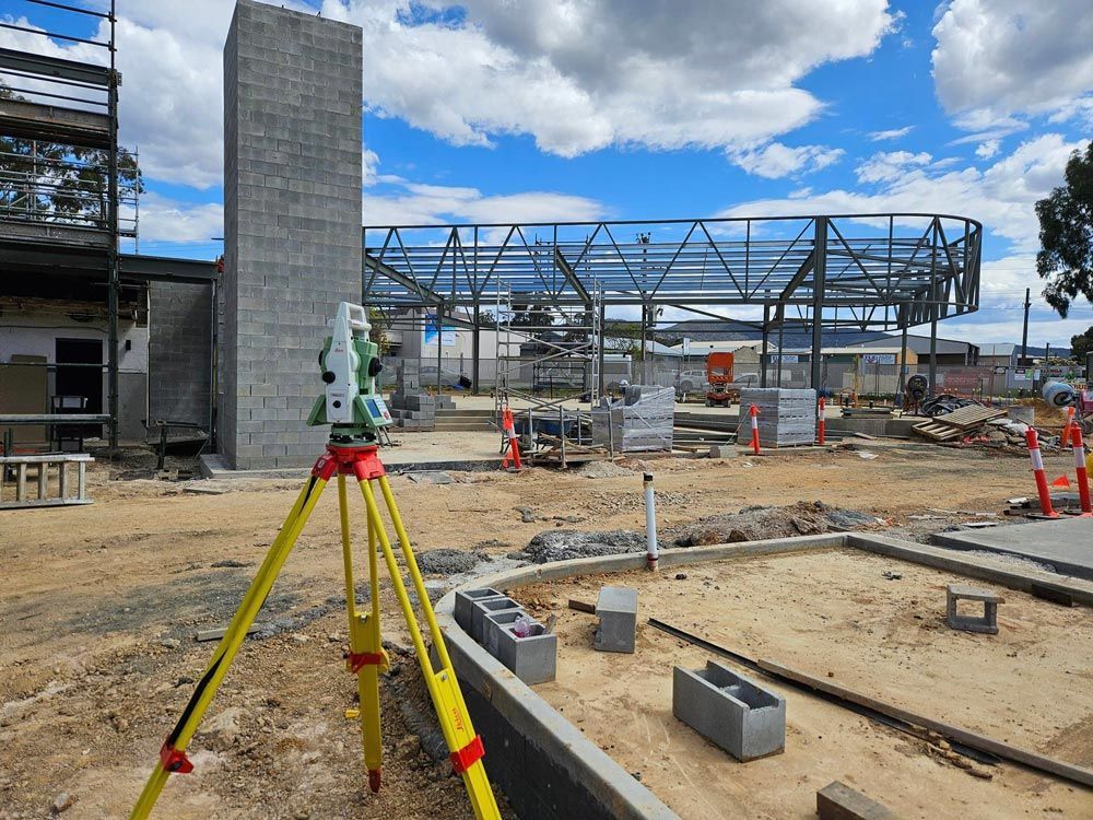
- Engineering & Construction Surveys: From project inception to completion, our team provides the data needed to execute your engineering and construction projects with accuracy and efficiency.
- Drone Surveys: We leverage cutting-edge technology to enhance our surveying capabilities. Drone surveys offer a unique perspective and allow us to capture data quickly and accurately, even in challenging terrain.
- Development: Whether you're planning a small-scale development or a large, complex project, we can assist you in gathering the essential data required for successful planning, design and regulatory compliance.
Why Choose Arête Survey Solutions?
Our dedication to efficiency and precision sets us apart. We understand the significance of the services we provide and the time-sensitive nature of land development projects. With every task we undertake, our goal is to not only meet but exceed your expectations, delivering unparalleled results that set the standard in the industry.
Meet Our Expert
Greg Doherty, our registered land surveyor, brings over 25 years of invaluable experience to the table. His surveying journey has taken him across the globe, with significant roles in Abu Dhabi, Dubai, New Caledonia and various locations throughout Australia. Greg's expertise and insights are a testament to our commitment to excellence and innovation.
The Role of Surveyors in Land Development
Surveyors play a pivotal role in land development projects. They are responsible for a variety of crucial tasks, including boundary surveys, topographic assessments and construction surveys. Surveyors also handle land title surveys to establish ownership rights and prepare legal documents, ensuring all transactions are legally sound. Moreover, surveyors contribute to site planning by providing essential data for infrastructure design and ensuring compliance with regulations. They are the cornerstone of successful land development, delivering accuracy, efficiency and adherence to legal requirements.
High-Quality Surveying & Spatial Services
At Arête Survey Solutions, we are driven by a passion for excellence and a commitment to providing you with the highest quality surveying and spatial services. Contact us today to discover how we can support your next project and experience the peak of professionalism in the industry. Your journey to excellence begins with Arête.
We handle all types of surveying requirements across Central West NSW, but we provide our services throughout the entire state. From Tweed Heads to Eden, or Sydney to Broken Hill, we’ve got your survey needs covered. A few of our general locations in the central area include, but are not limited to:
If your location isn’t listed, please reach out anyway—we are happy to travel to accommodate your needs!
Boundary surveys play a crucial role in establishing and maintaining accurate land records and property boundaries. They help ensure the integrity and reliability of land ownership and property rights.
Looking into subdividing your land? We prepare subdivision and development plans for the purposes of issuing a new Certificate of Title.
Contour and detail surveys are a prerequisite for building and land development. Generally speaking, their purpose is to indicate features on and adjacent to a property.
Common types of engineering surveys include construction surveys, topographic surveys, control surveys and deformation monitoring surveys. They play a crucial role in ensuring accurate and efficient construction and development projects.
We pride ourselves on utilising the latest in surveying technologies. From aerial perspectives via drone to 3D scanning through lasers, we can provide accurate and detailed spatial data.
As part of the creation of lease plans, we provide plans of survey information and easements, including detailed site surveys, site coordination and tower location surveys for rights of carriageway and electricity services.
FAQ's